Reductio ad Trafficum
The title of this post makes perfect sense, and therefore it doesn’t. Ergo, reductio ad absurdum. Logic surely is an interesting field and I think I’ll venture into it if the COVID-19 outbreak lasts long enough.
That aside, I thought it’d be a good idea to visualize traffic changes brought about by COVID-19 in cities around the world. Essentially, automating the process of navigating to various cities on Google Maps and using the information availabe to compare traffic during the outbreak (“live traffic”) and typical traffic at peak hours.
At the time of writing, the number of green pixels on every map seems quite large compared to the typical case!
Here are some results.
| Traffic during COVID-19 | Peak traffic, typically |
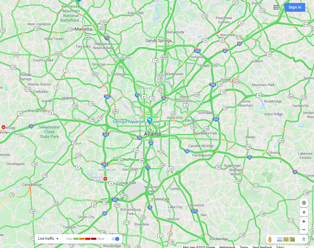
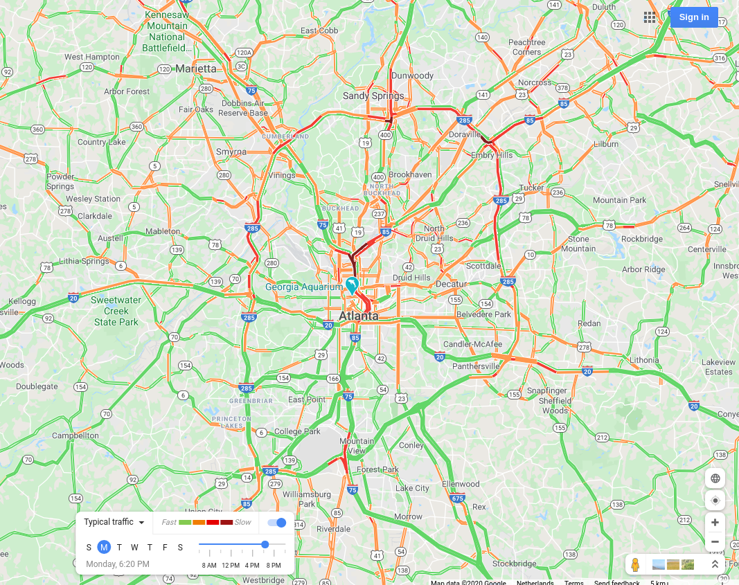
Atlanta, USA |
 |
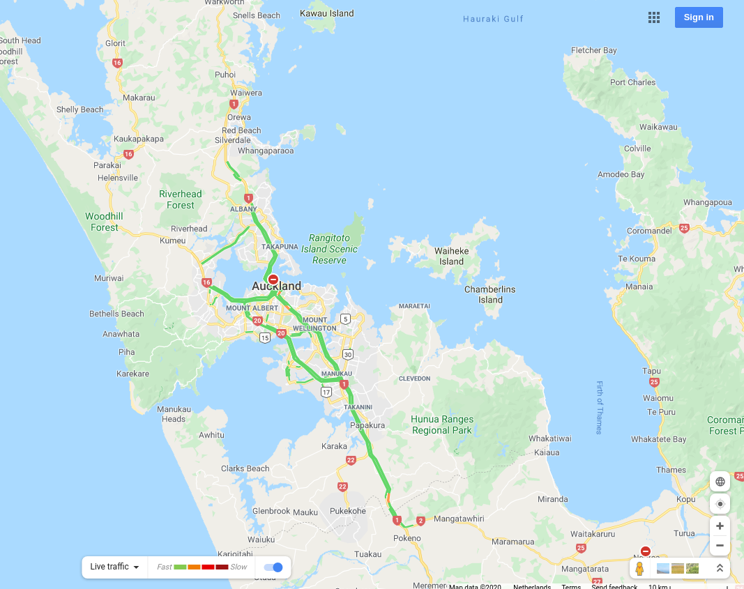
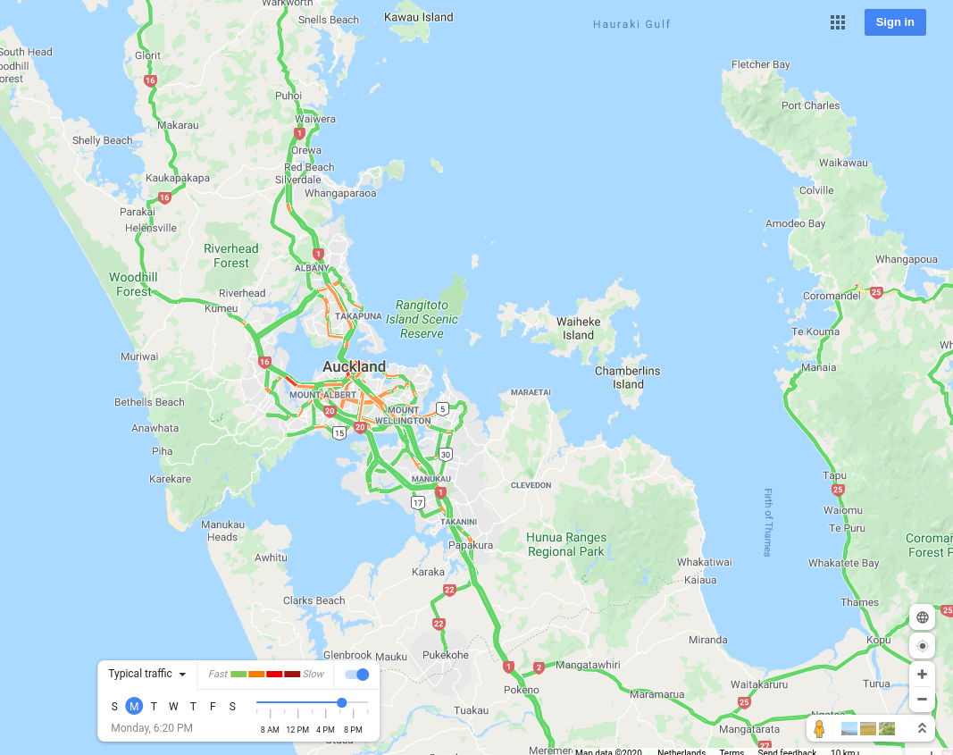
Auckland, New Zealand |
 |
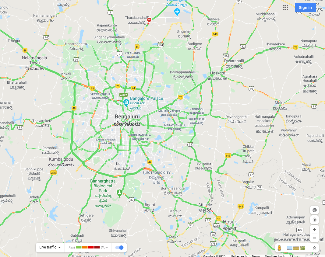
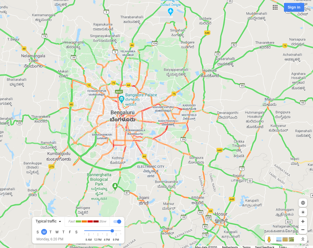
Bengaluru, India |
 |
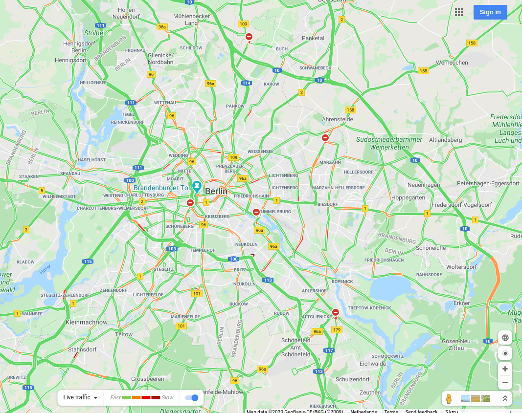
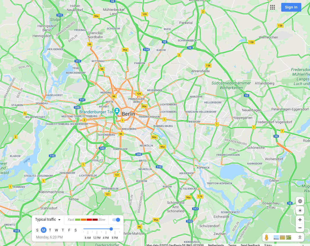
Berlin, Germany |
 |
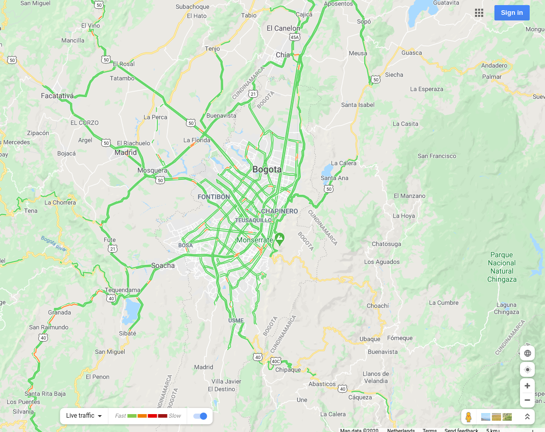
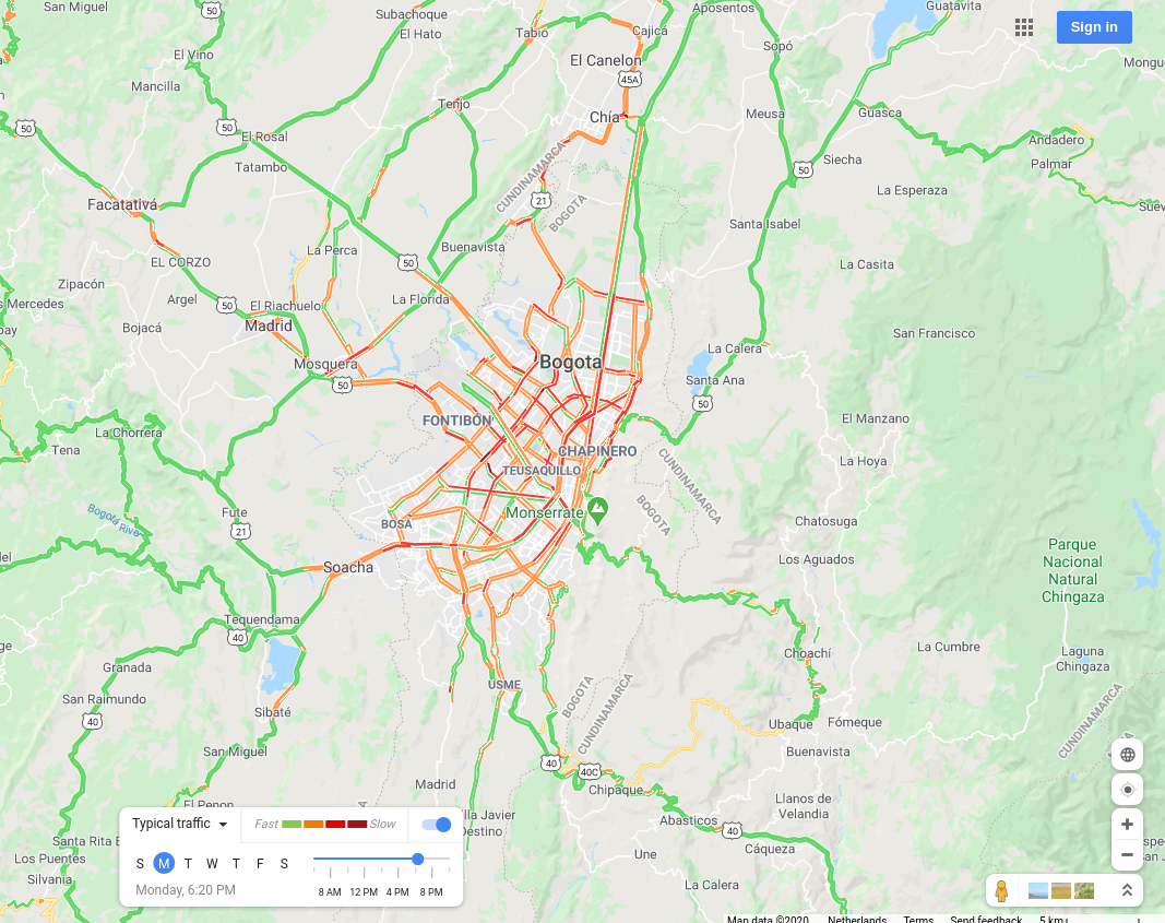
Bogota, Colombia |
 |
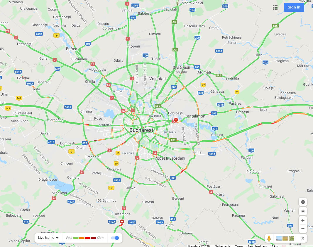
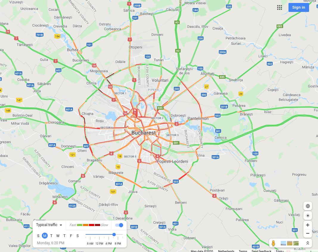
Bucharest, Romania |
 |
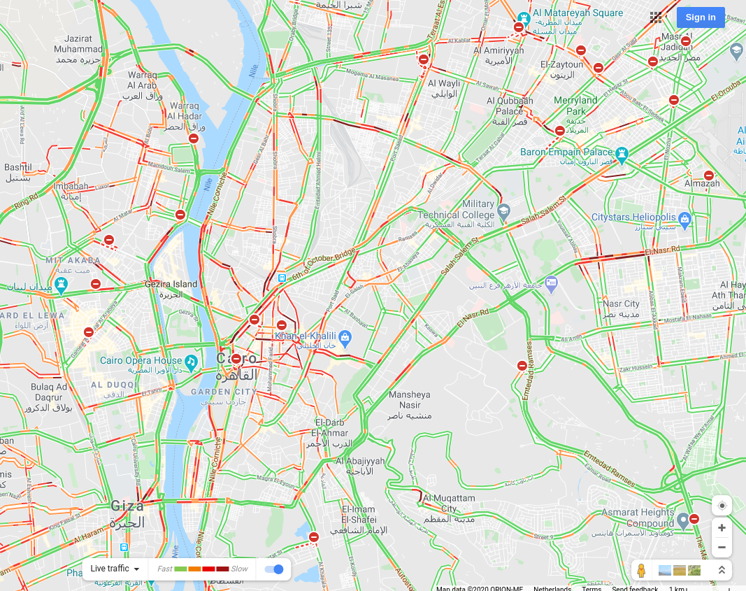
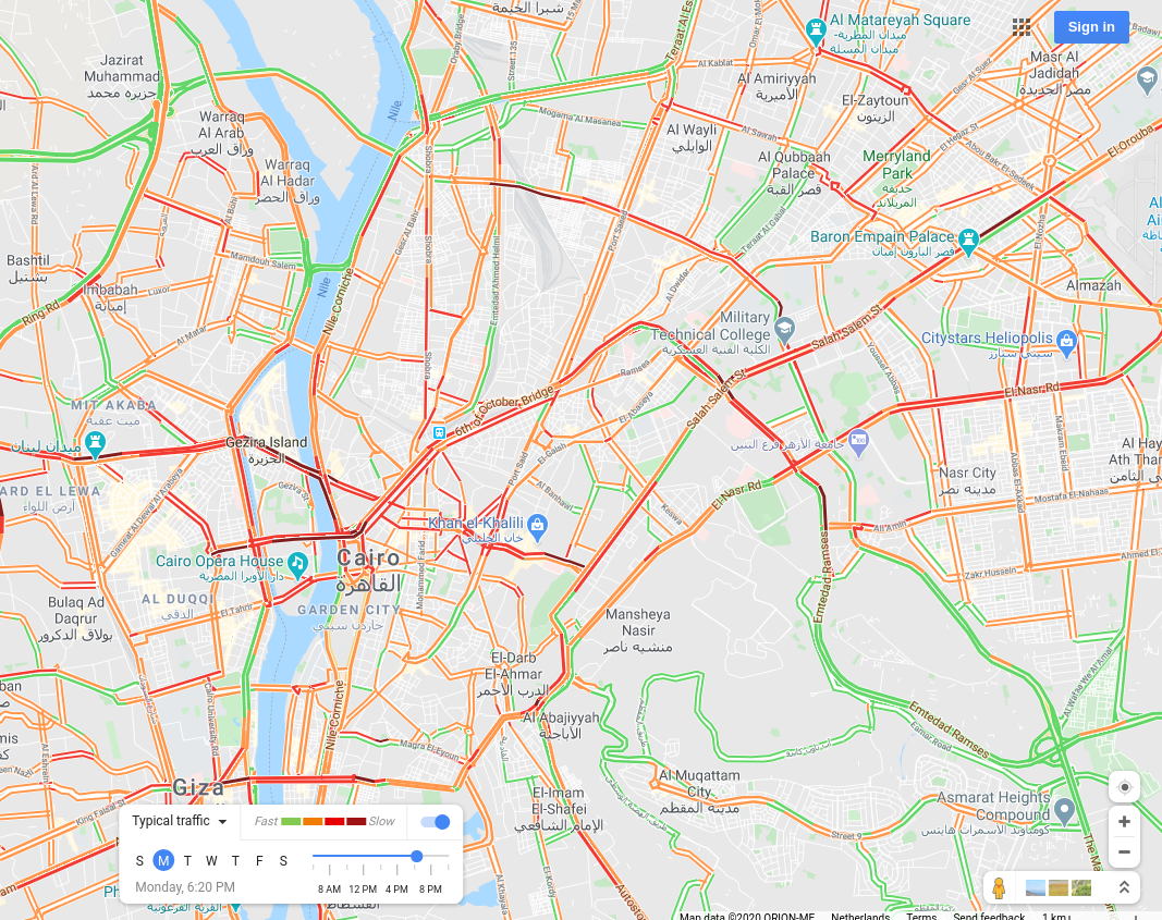
Cairo, Egypt |
 |
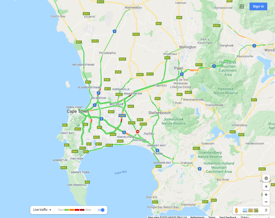
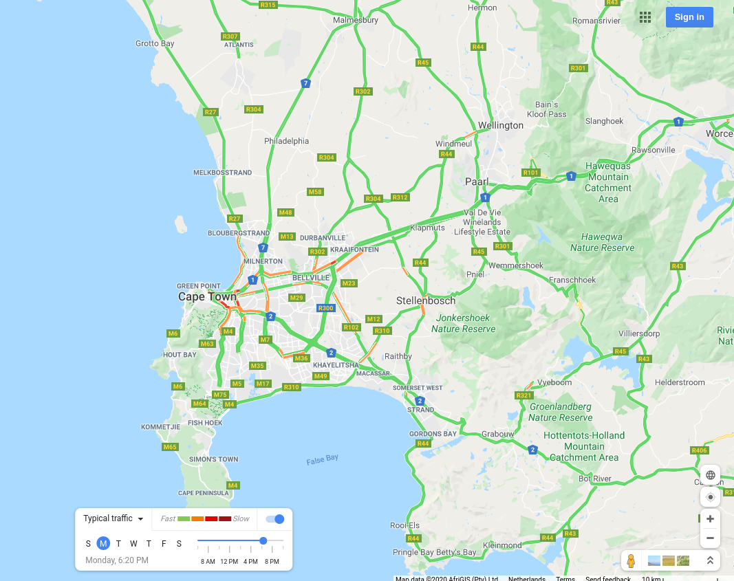
Cape Town, South Africa |
 |
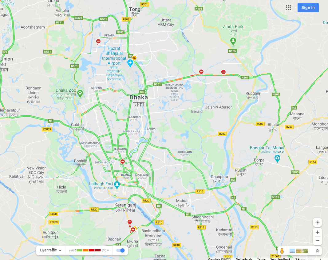
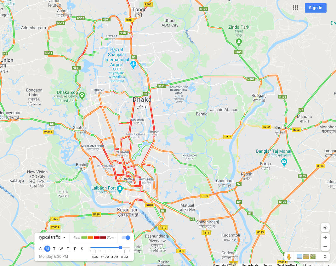
Dhaka, Bangladesh |
 |
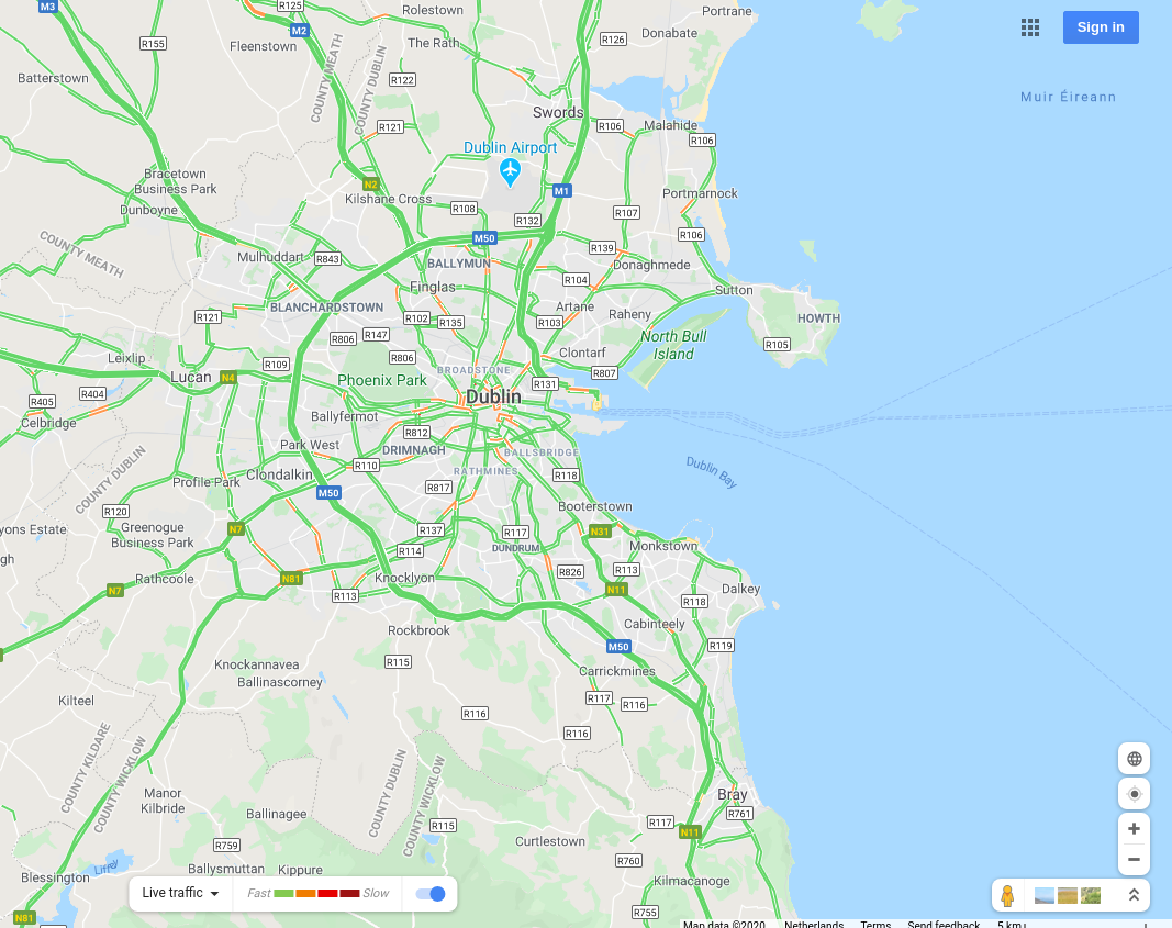
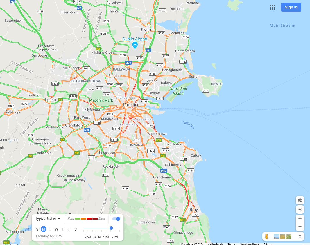
Dublin, Ireland |
 |
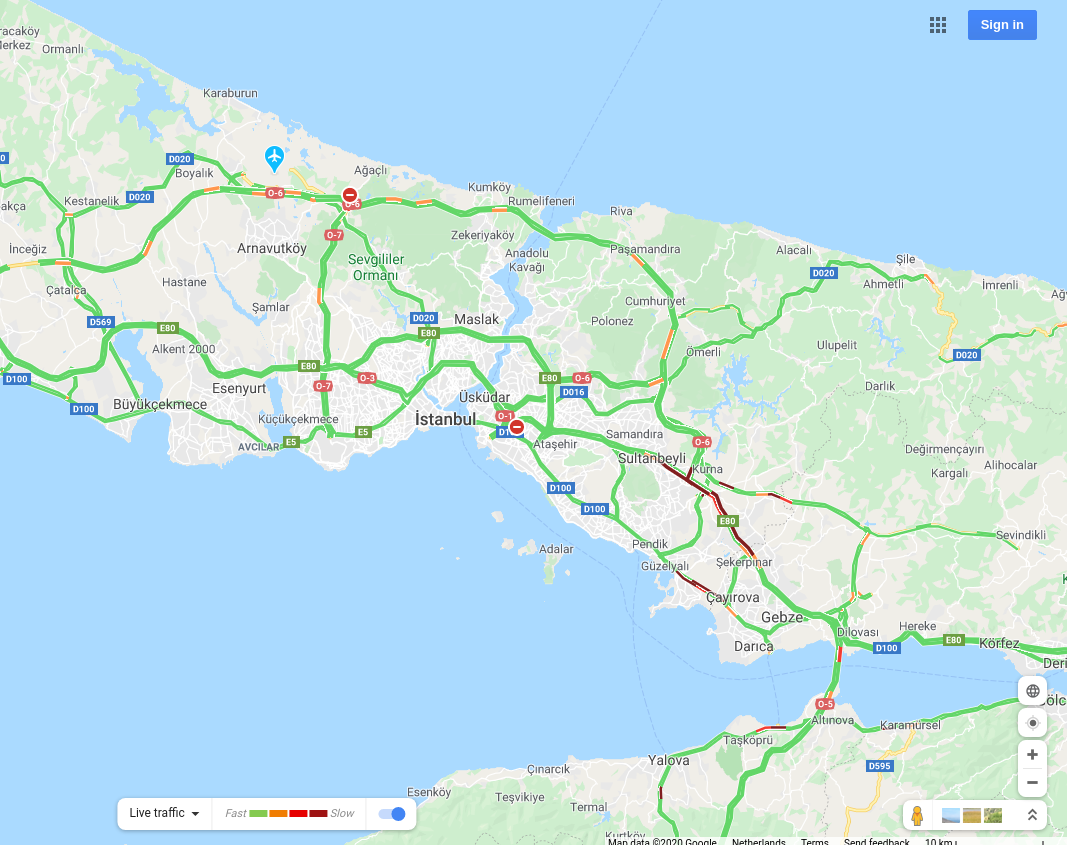
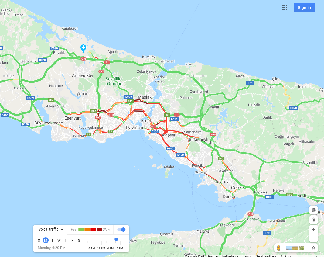
Istanbul, Turkey |
 |
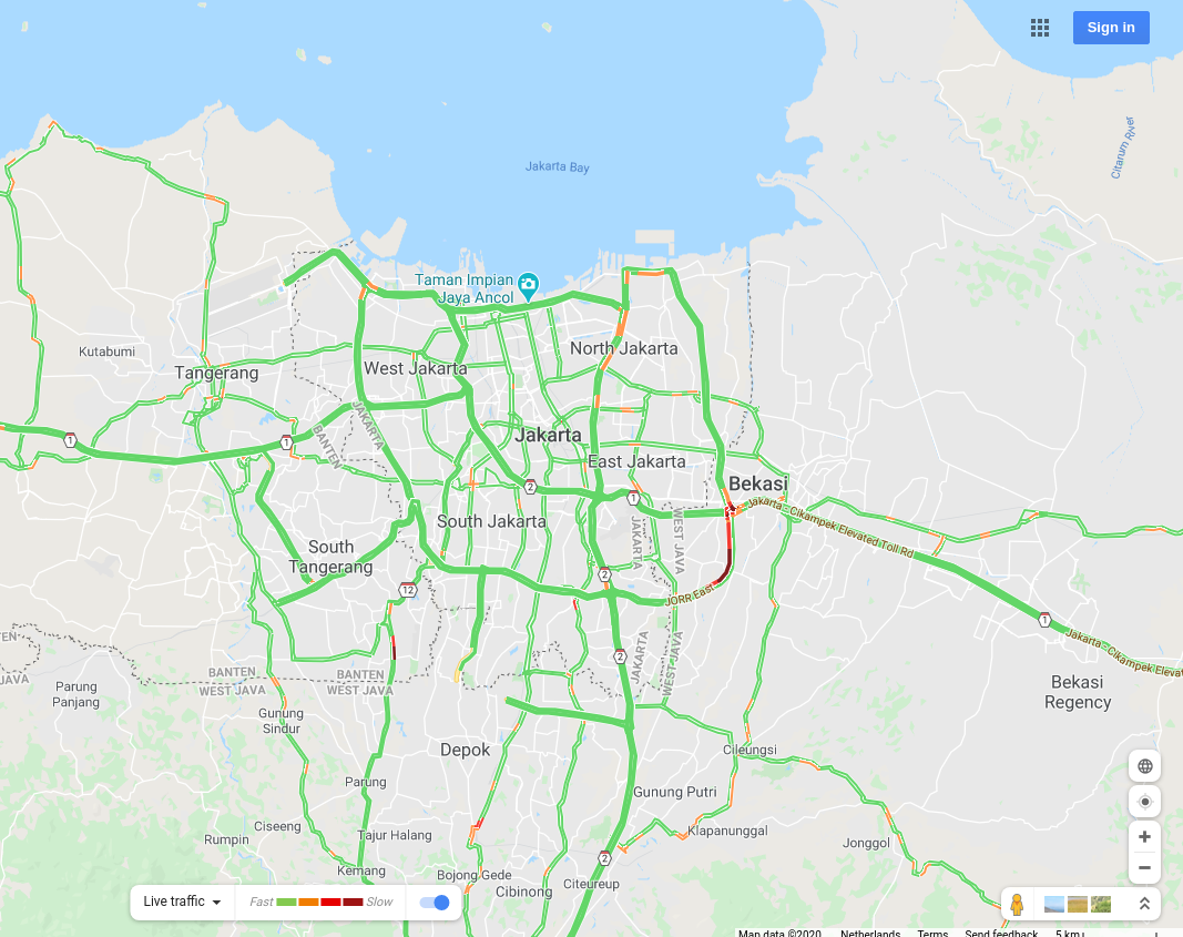
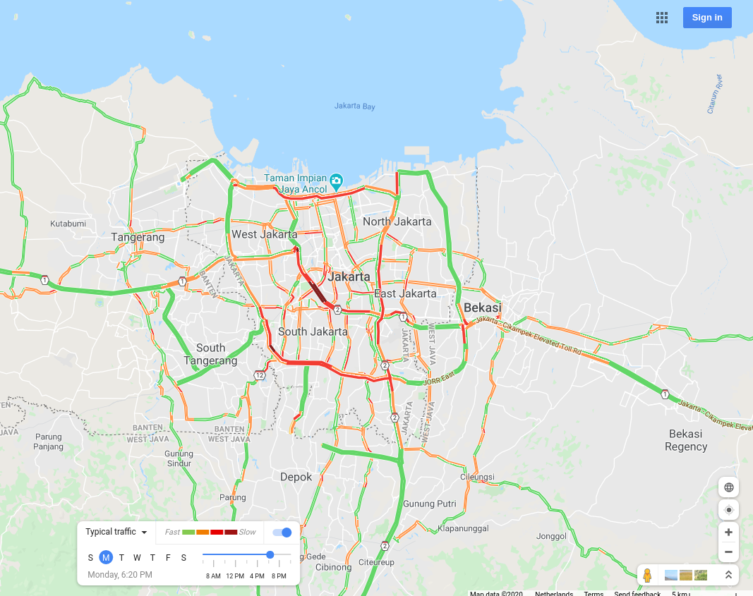
Jakarta, Indonesia |
 |
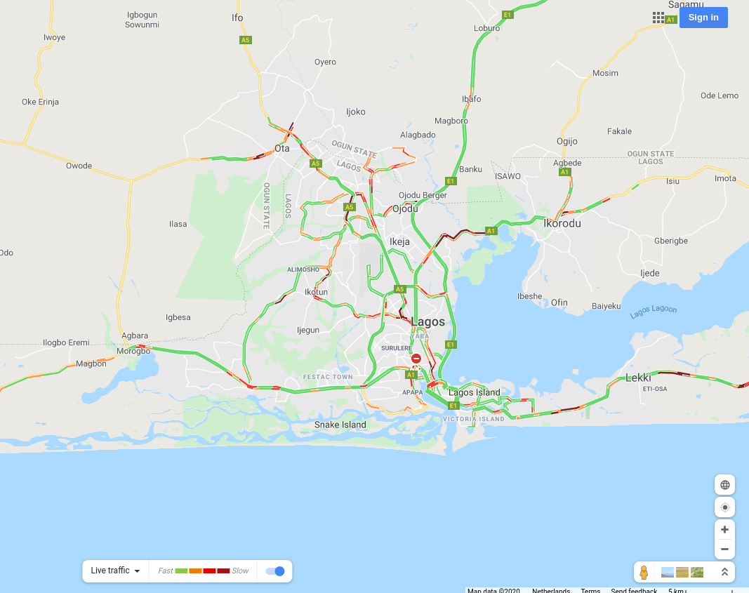
Lagos, Nigeria |
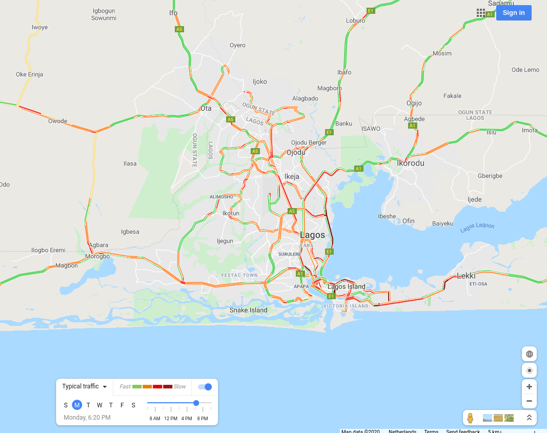 |
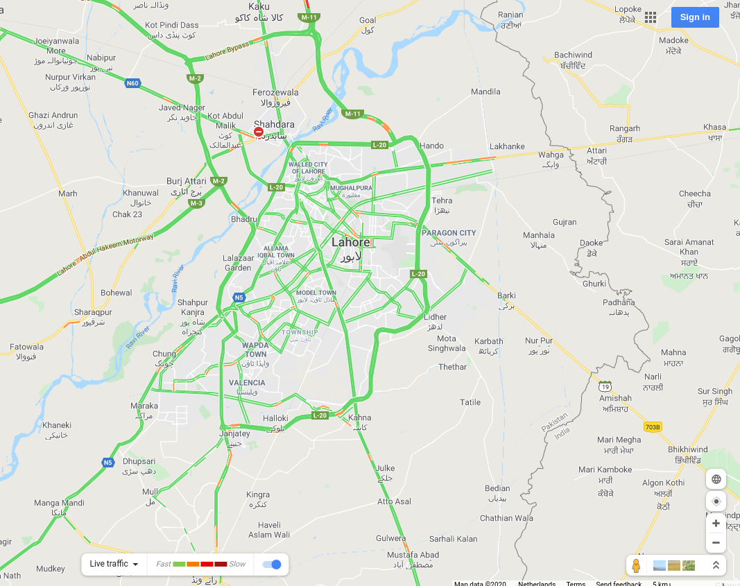
Lahore, Pakistan |
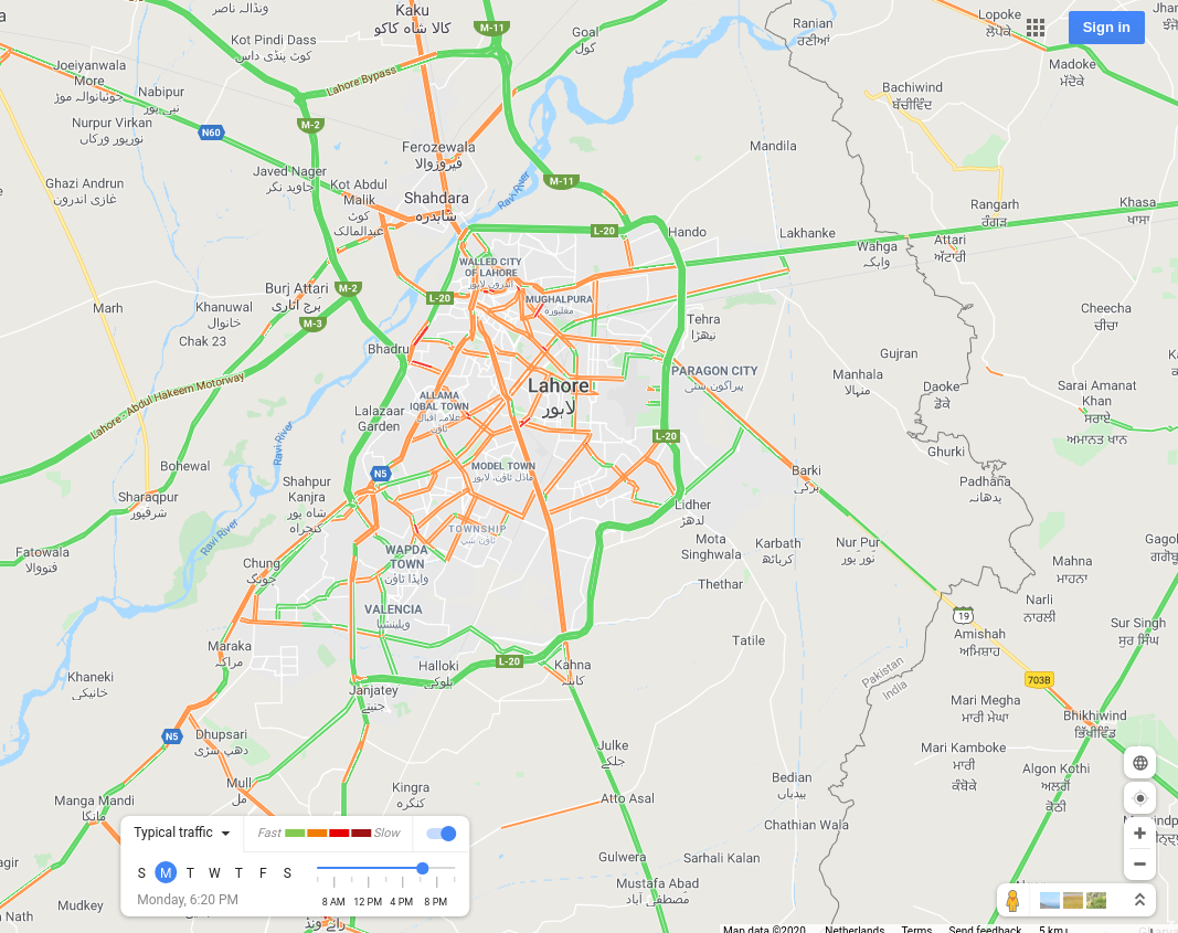 |
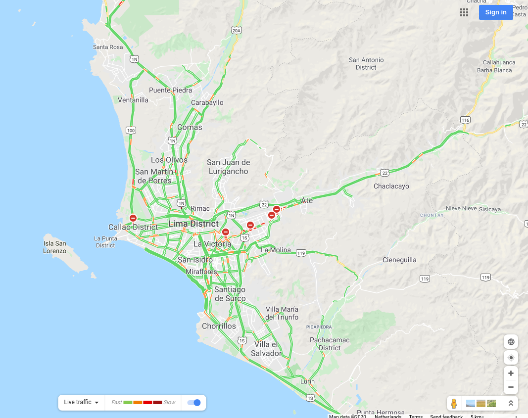
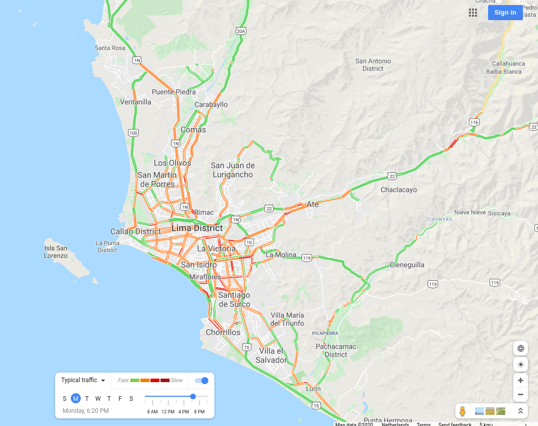
Lima, Peru |
 |
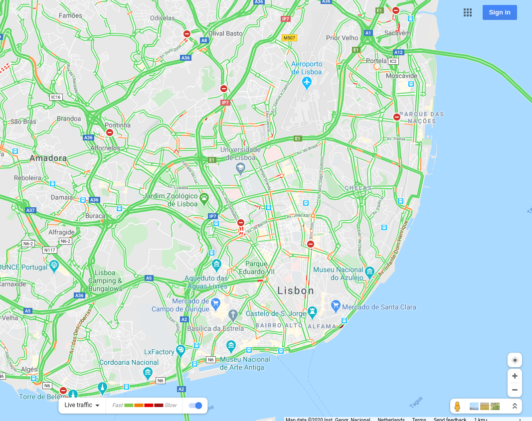
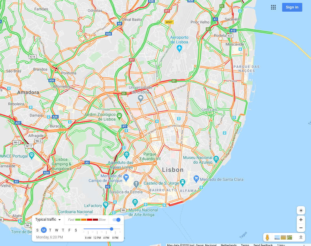
Lisbon, Portugal |
 |
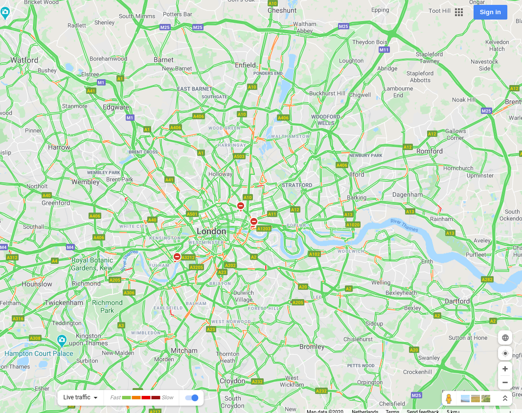
London, UK |
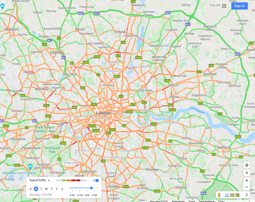 |
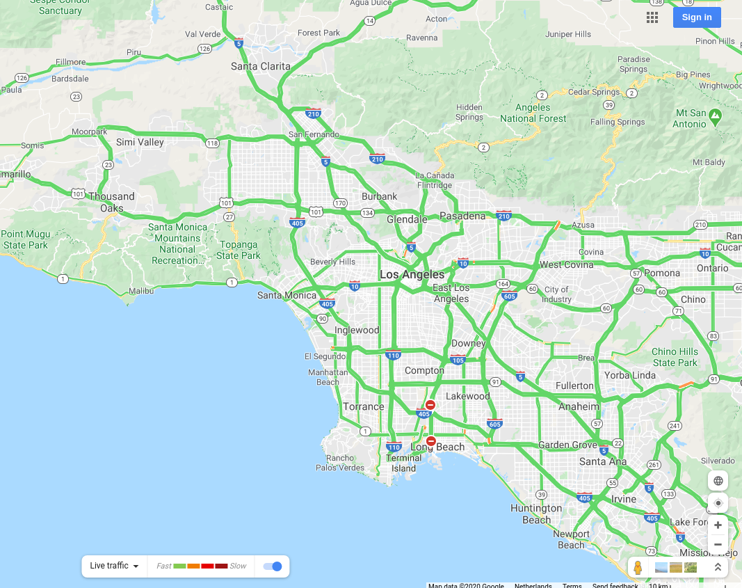
Los Angeles, USA |
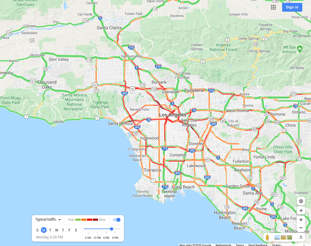 |
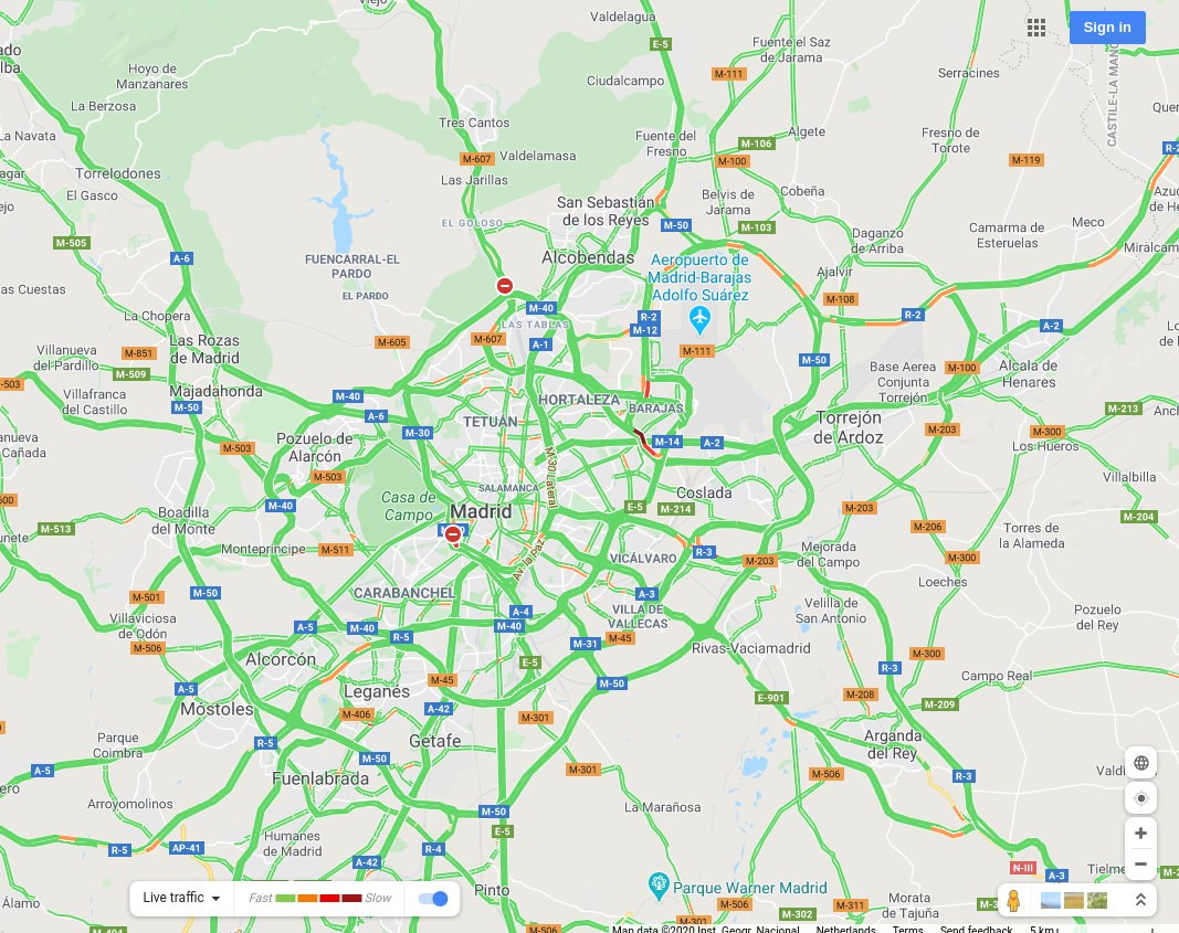
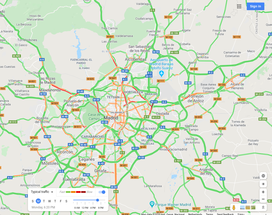
Madrid, Spain |
 |
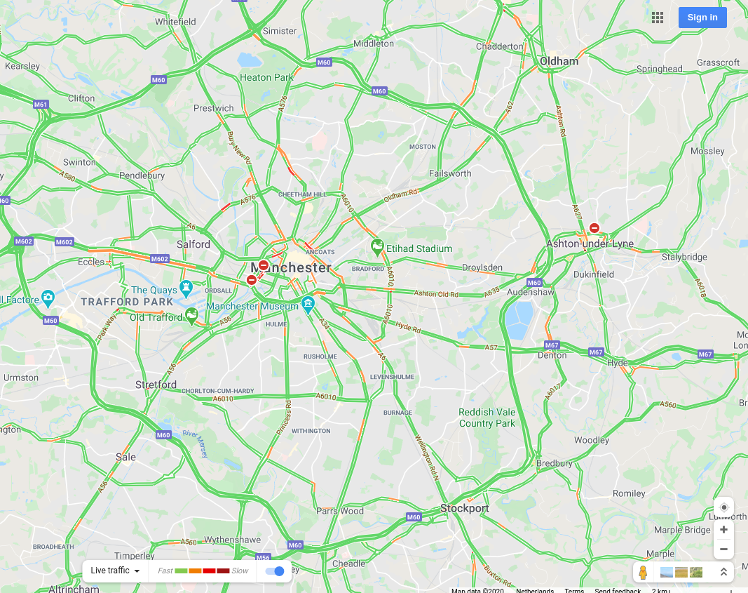
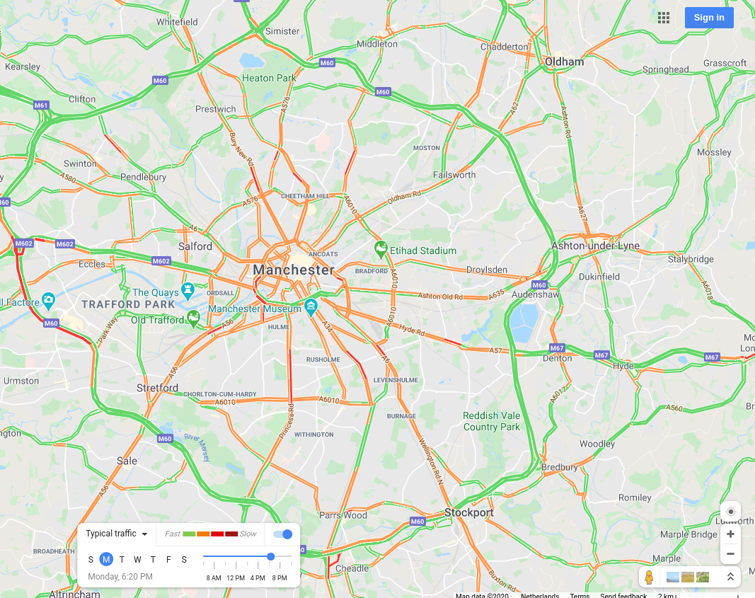
Manchester, UK |
 |
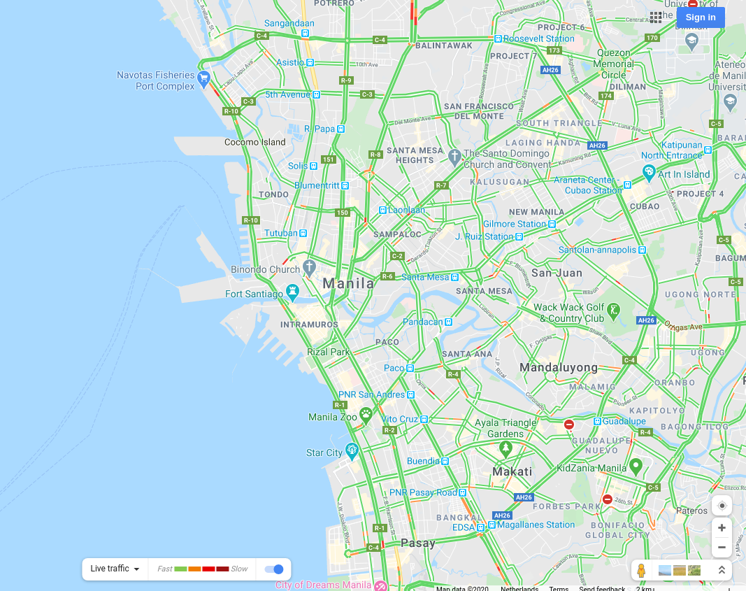
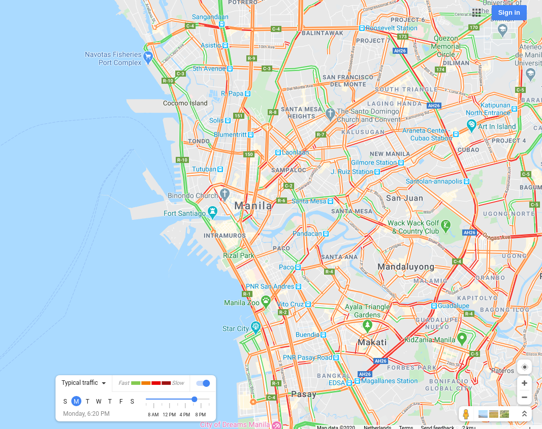
Manila, The Philippines |
 |
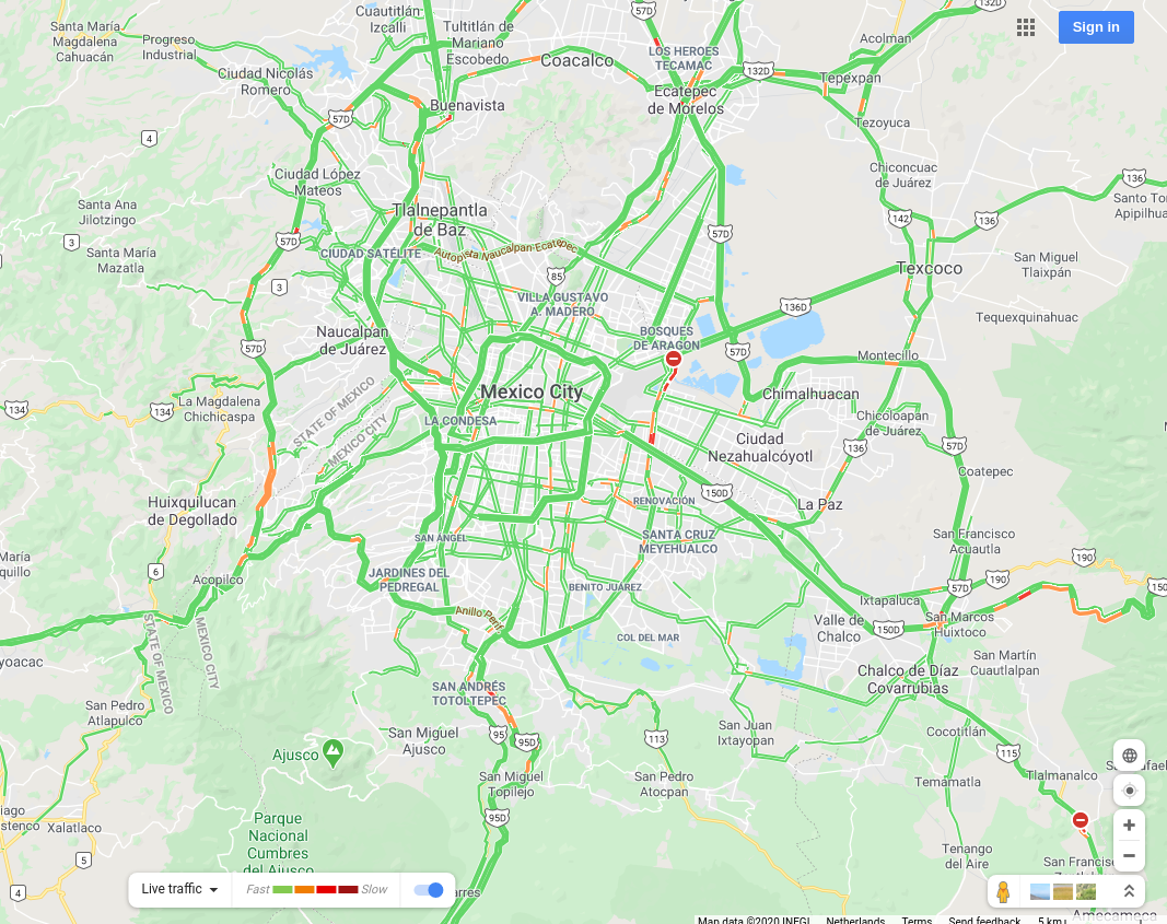
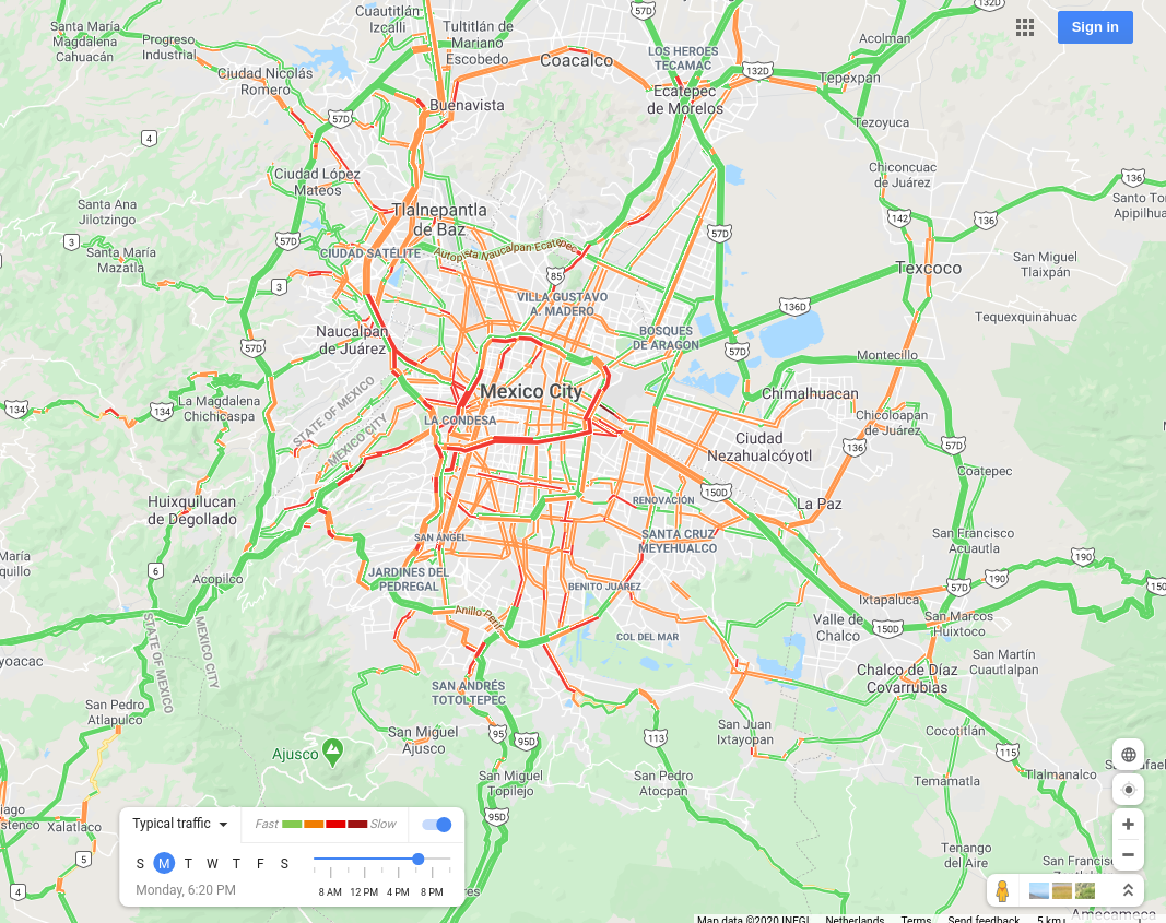
Mexico City, Mexico |
 |
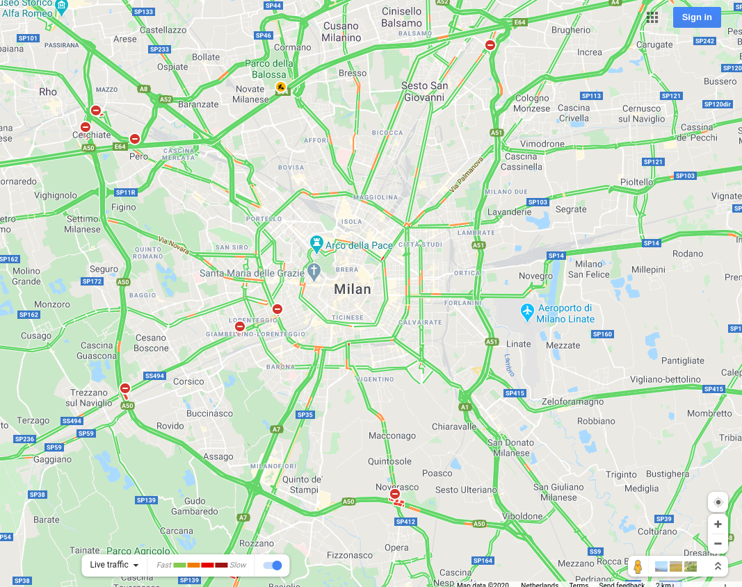
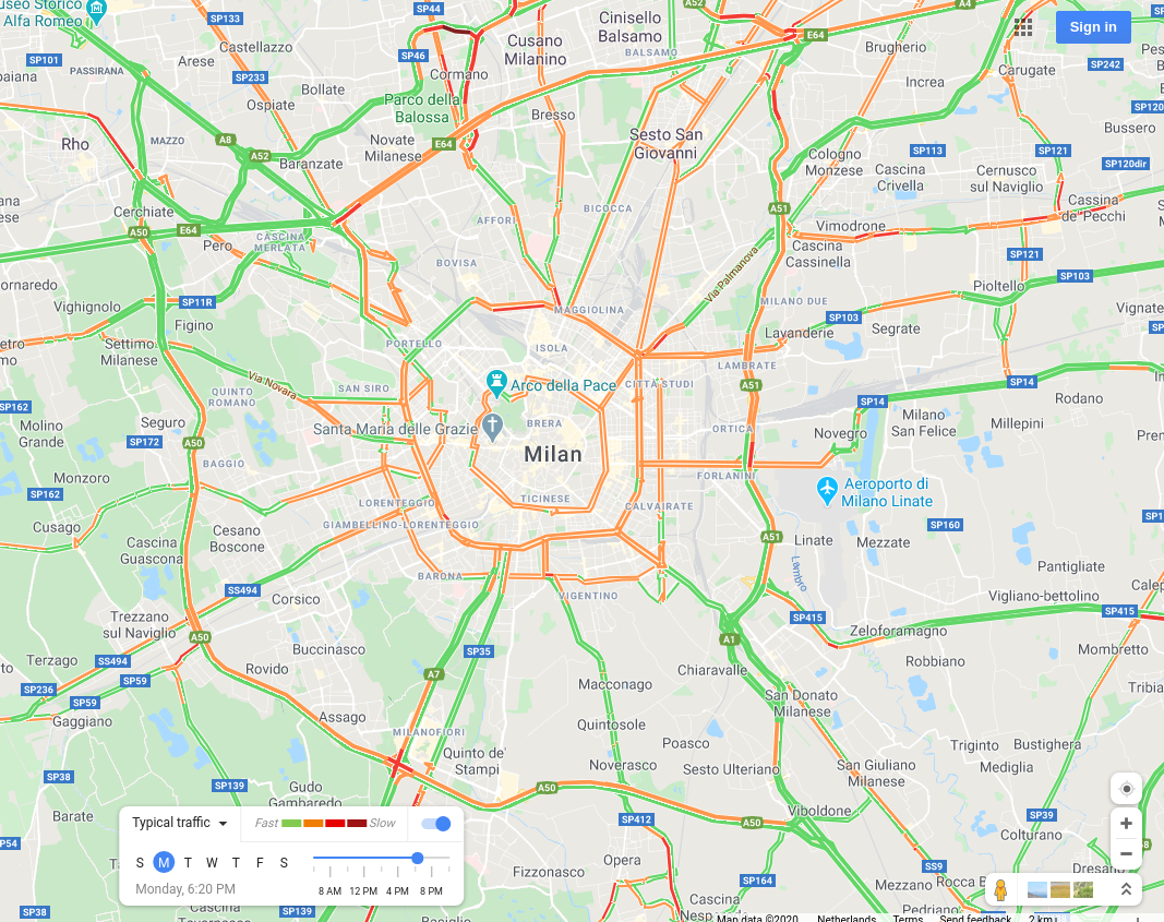
Milan, Italy |
 |
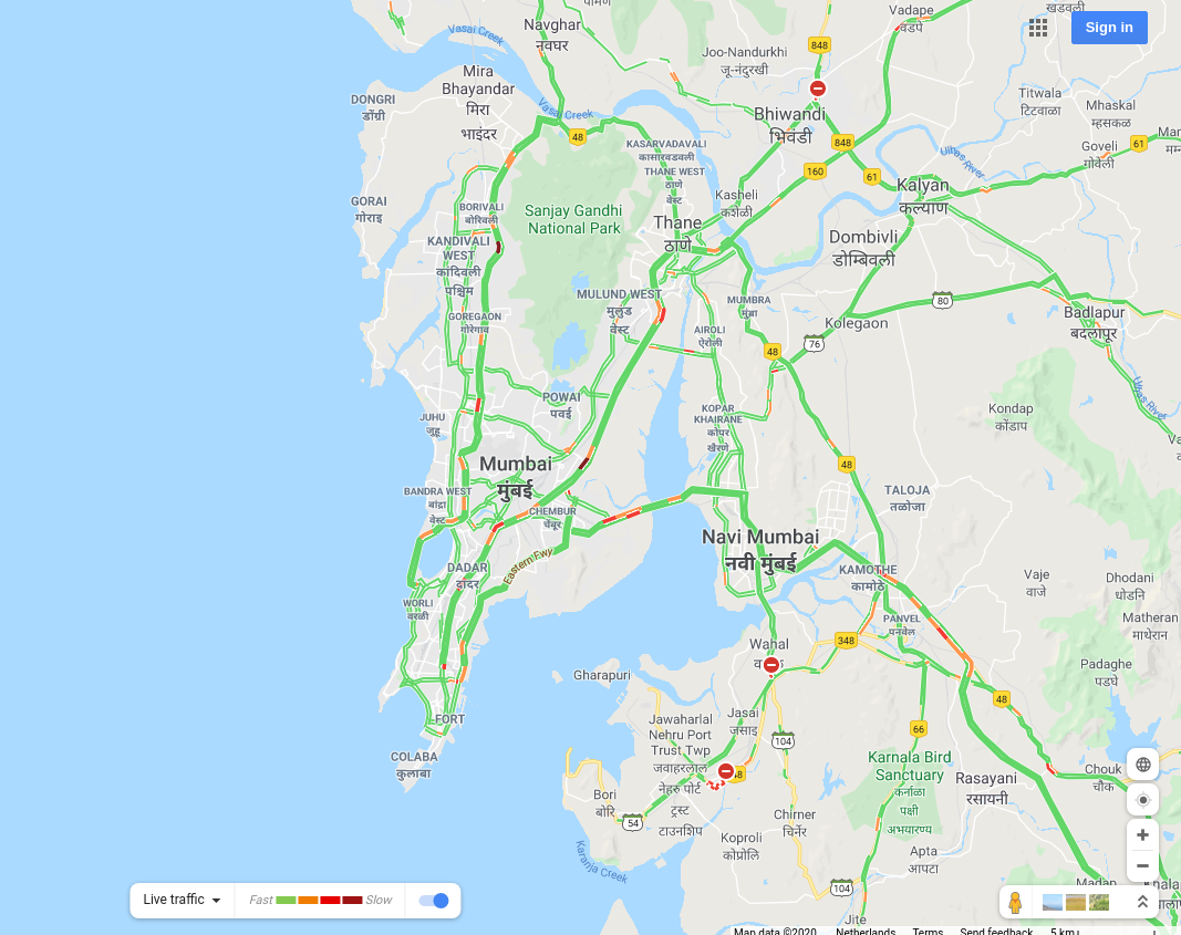
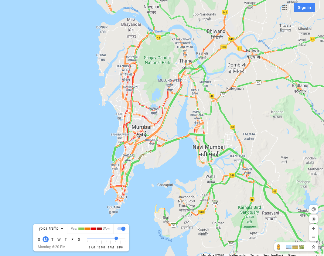
Mumbai, India |
 |
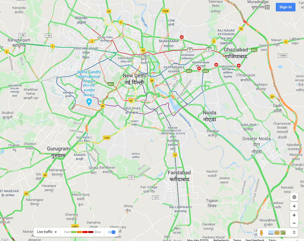
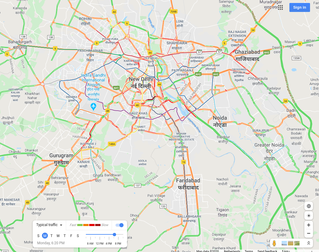
New Delhi, India |
 |
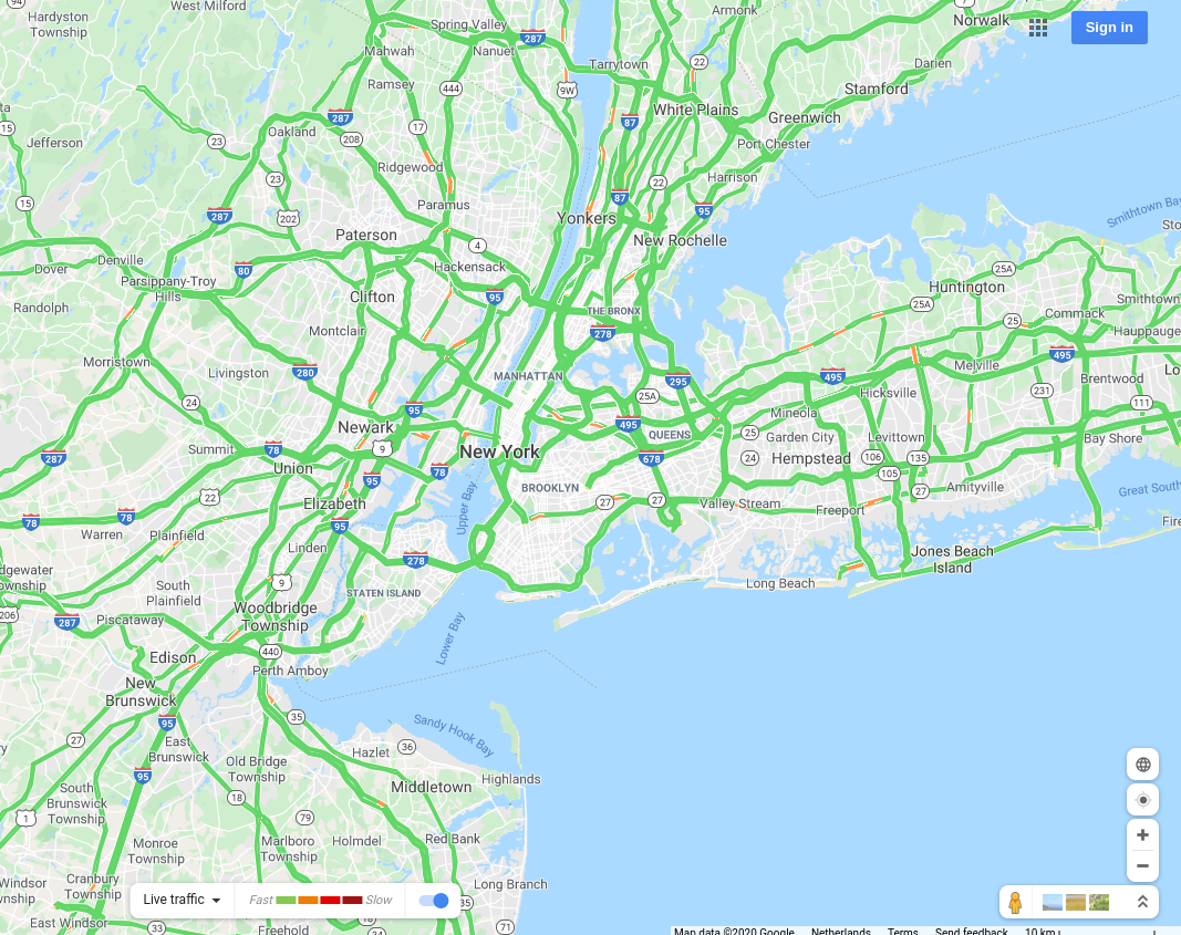
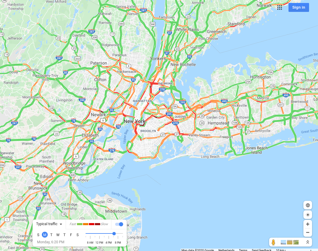
New York City, USA |
 |
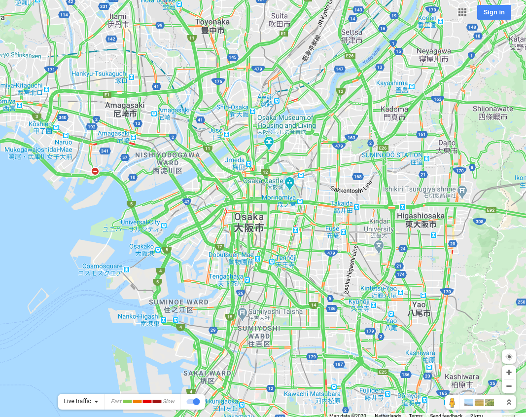
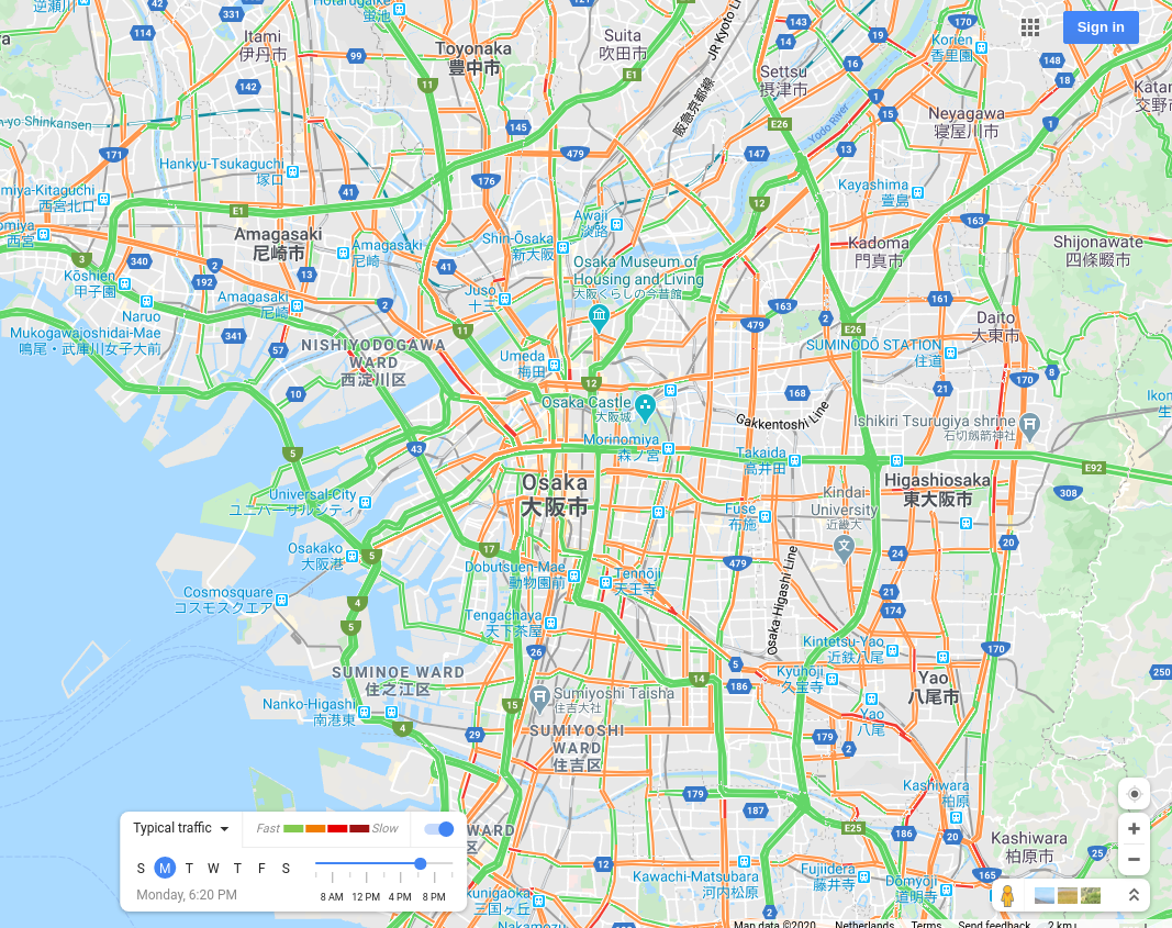
Osaka, Japan |
 |
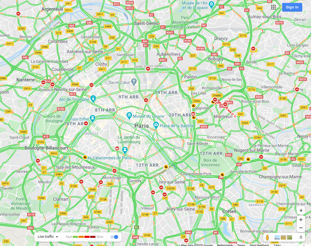
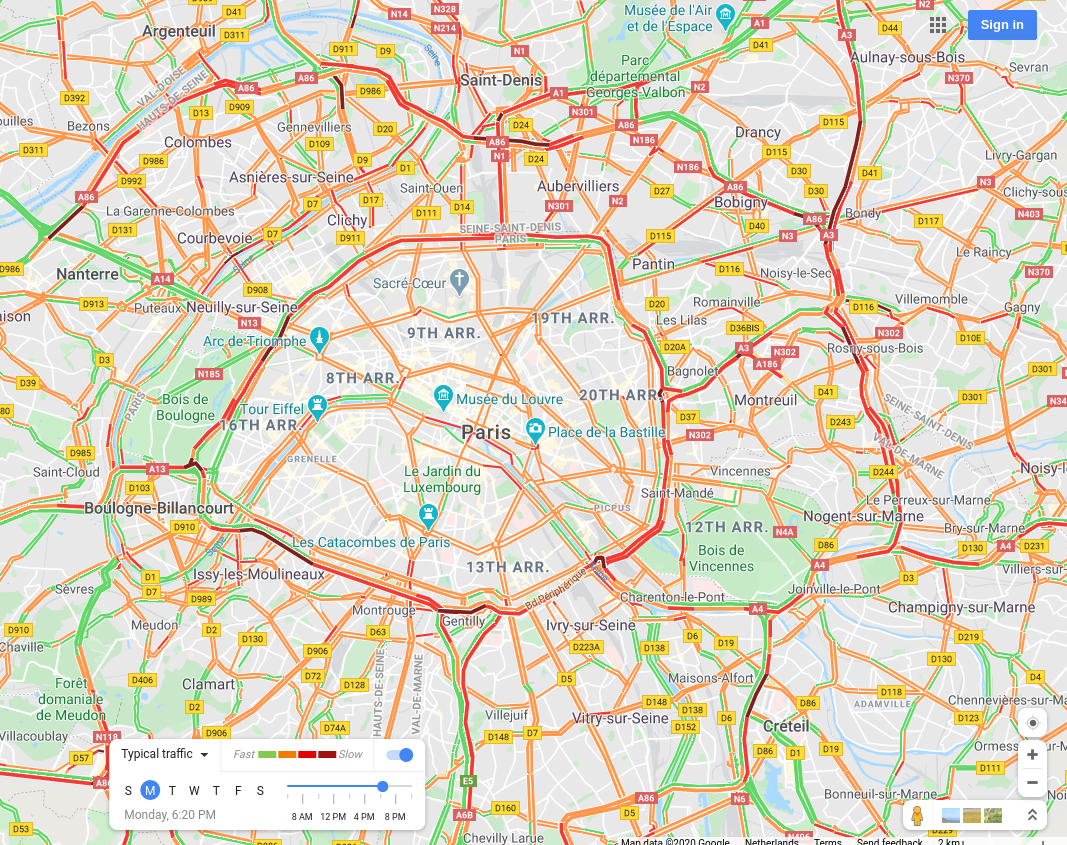
Paris, France |
 |
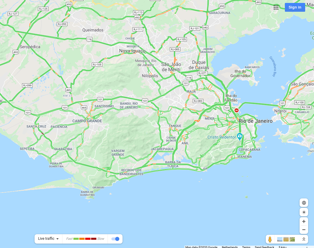
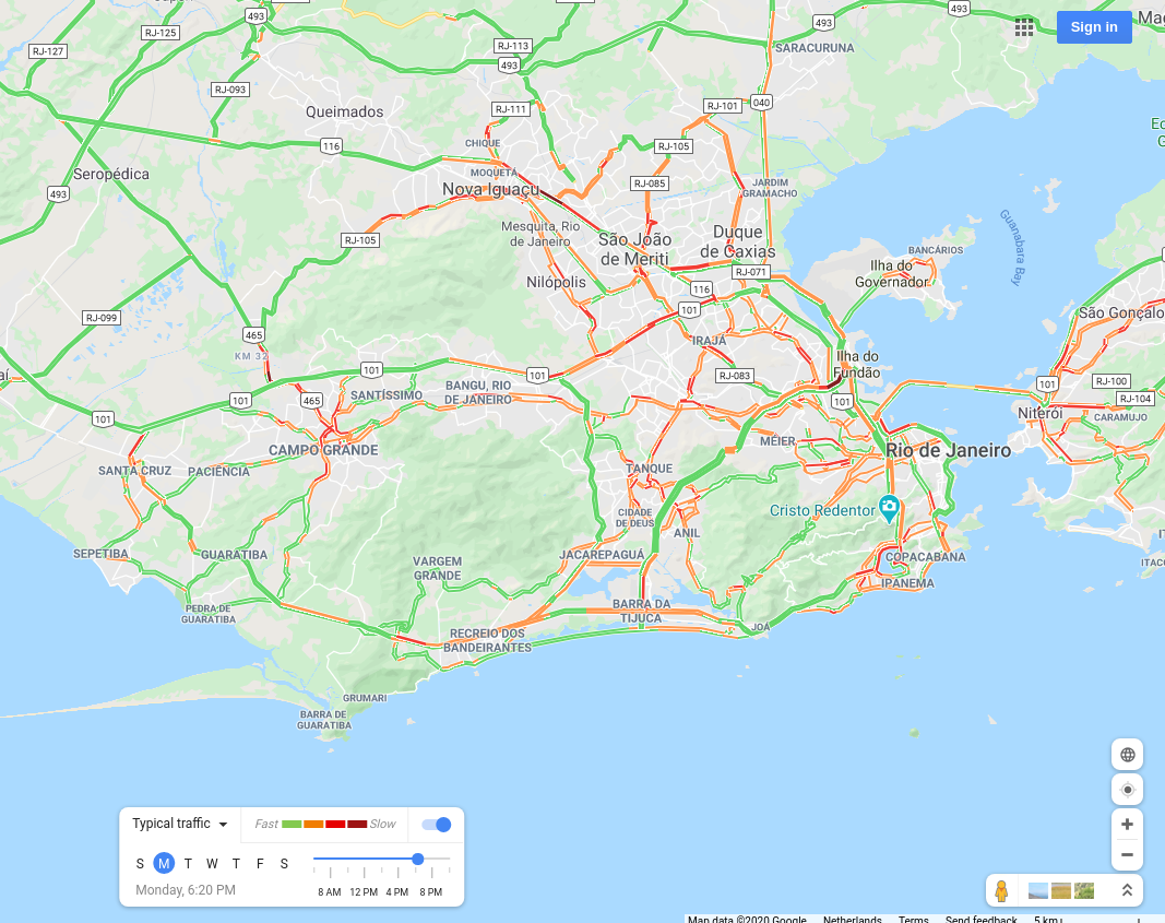
Rio de Janeiro, Brazil |
 |
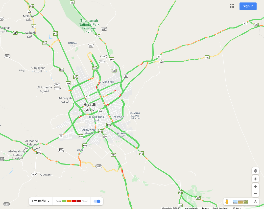
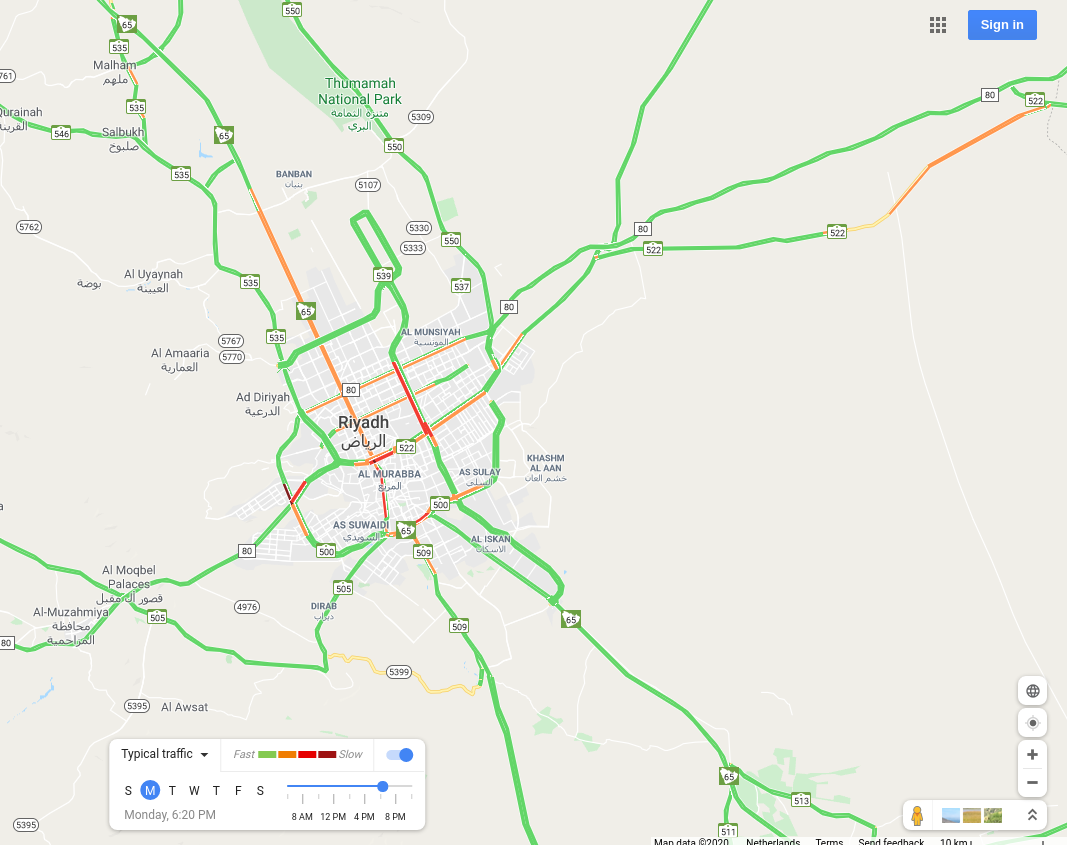
Riyadh, Saudi Arabia |
 |
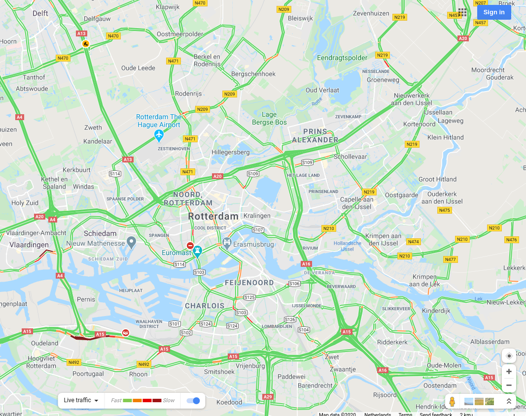
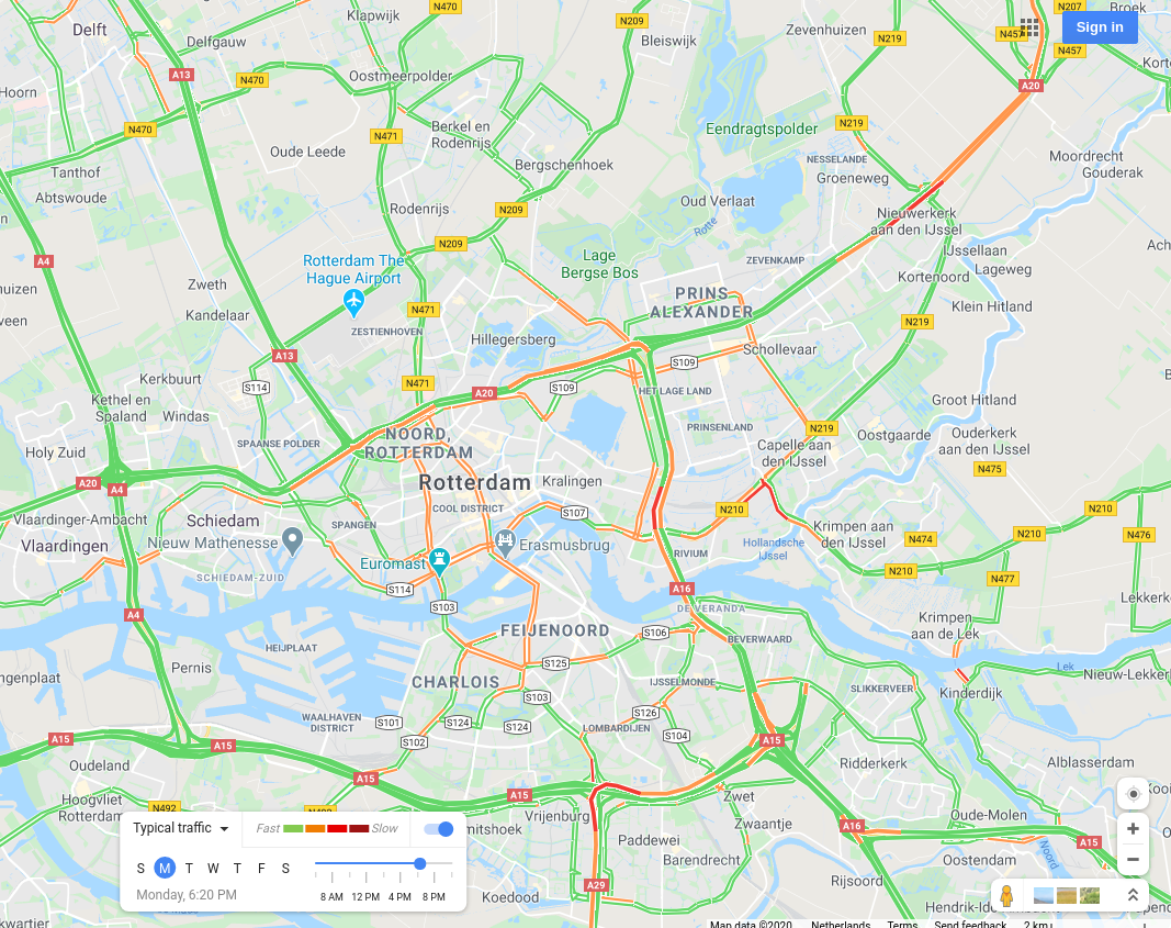
Rotterdam, The Netherlands |
 |
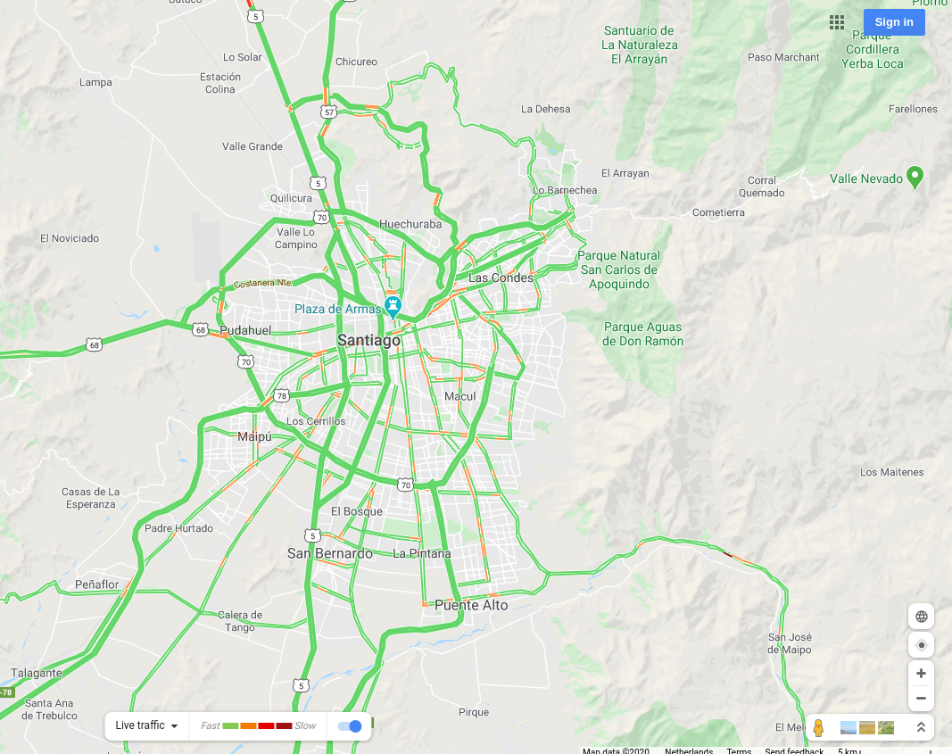
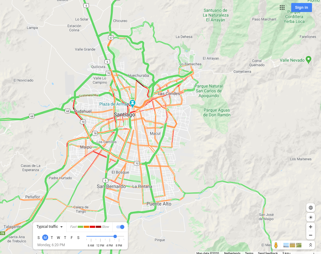
Santiago, Chile |
 |
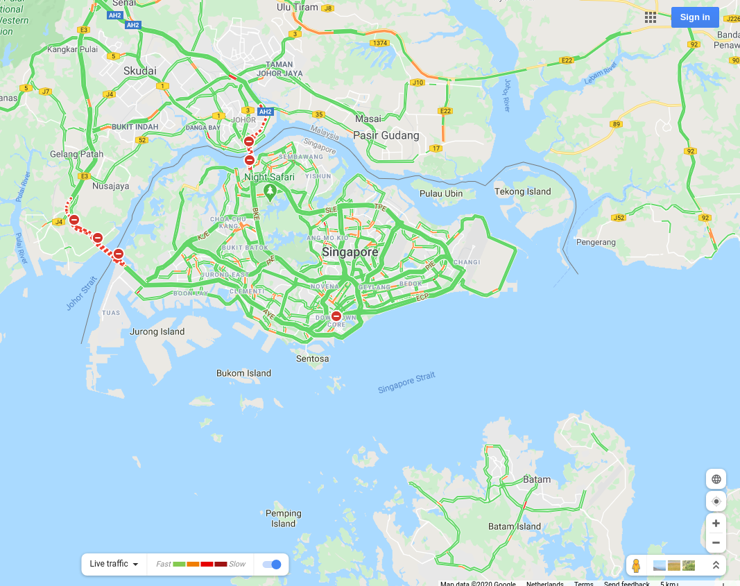
Singapore, Singapore |
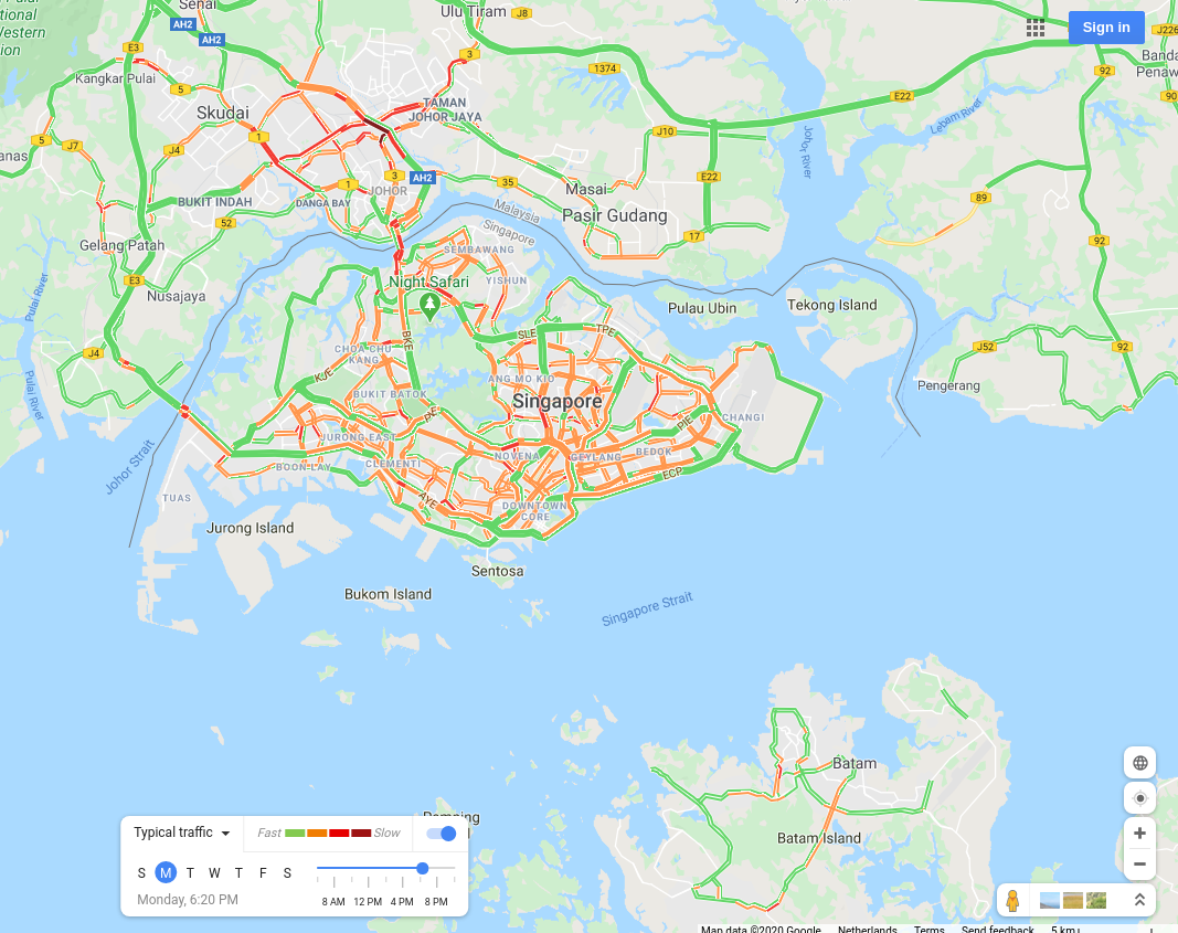 |
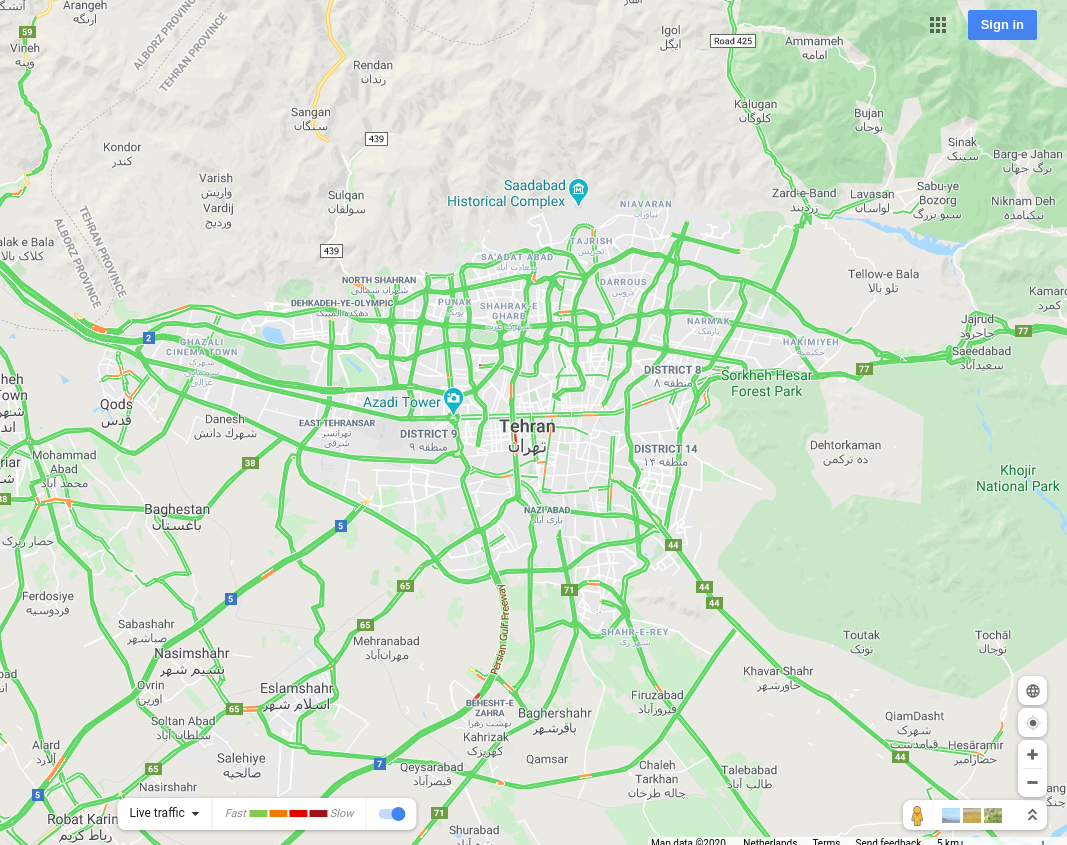
Tehran, Iran |
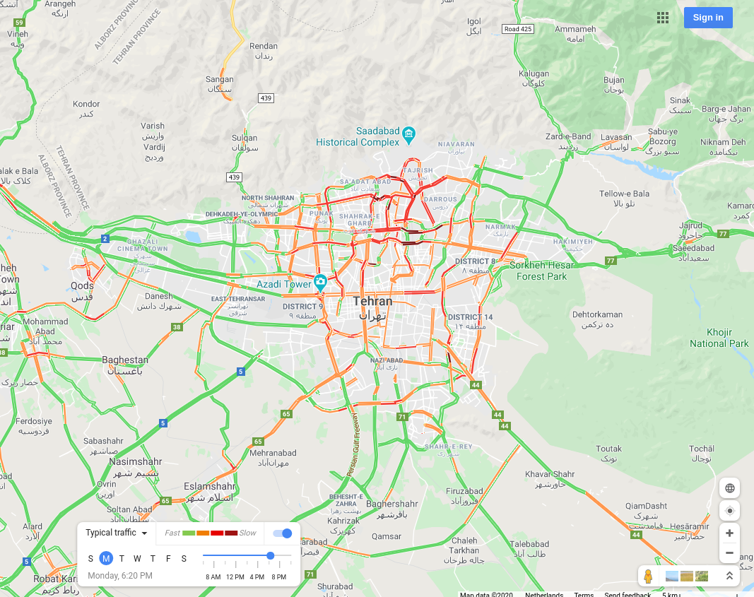 |
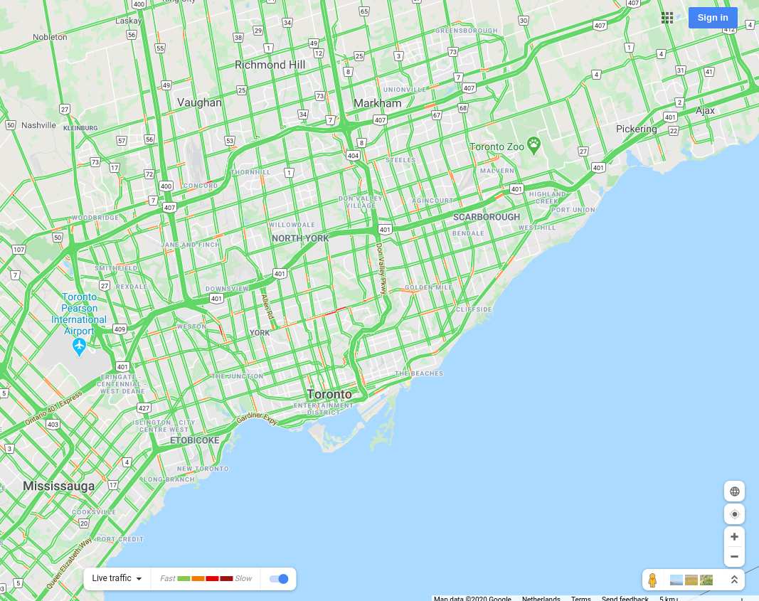
Toronto, Canada |
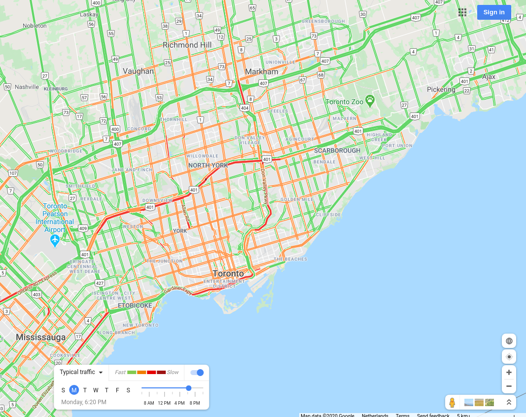 |
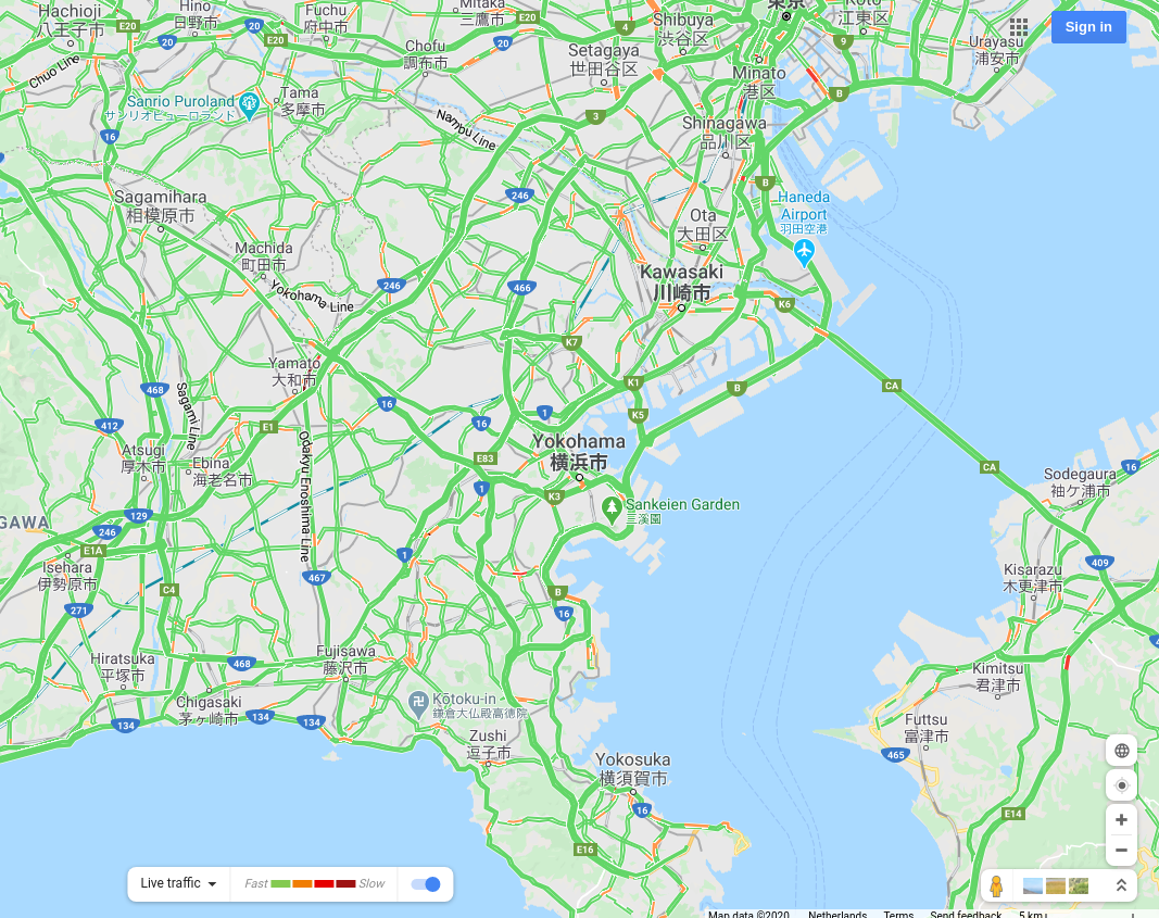
Yokohama, Japan |
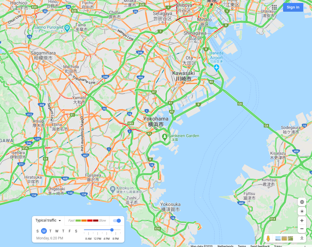 |
Observation
The trend is clearly visible on a global scale, though there is a difference in the magnitude of the impact across different cities. Most major cities have seen a significant departure from their usual traffic patterns, quite in line with the observed ground reality of our daily lives getting massively disrupted.
The list shown above wasn’t based on any particular research, but merely on a whim. Check out the project’s GitHub repository for instructions on how to visualize this for any city whose traffic information is available on Google Maps.
Let’s hope that this situation settles down soon and we come out with some key lessons learned in our post-pandemic world, slow as the recovery may be.
Bonus
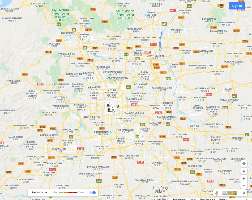
Since China does not allow Google to get much information, this approach does not work there at all.
| Beijing, during COVID-19 | Beijing's peak traffic, typically |
 |
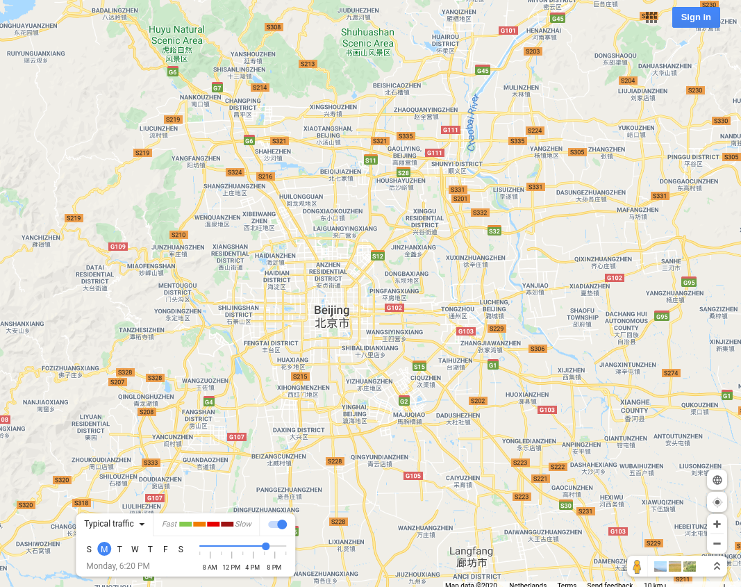 |
But I am sure the same information can be obtained from Baidu Maps if one really wants it.
Bonus 2
I had Seoul on my list as well, but the maps seemed a bit off compared with the rest of the world. That’s when I researched and found out that South Korea has some concerns about Google Maps.